The 9th Annual “My California GIS Mapping Showcase and Competition” encourages middle (4th-8th grade) and high school (9th-12th grade) students to harness the power of Geographic Information Systems. Students choose an issue, story, or event within the state to examine in depth. They use ArcGIS Online to access geographic data and analysis tools and then produce a StoryMap that shares their results and insights. Continue reading My California GIS Mapping Showcase and Competition (9th Annual)→
The California Geographic Alliance is proud to announce the winners of the 8th Annual My California GIS Mapping Showcase and Competition.
This exciting statewide opportunity encourages middle (4th-8th grade) and high school (9th-12th grade) students to harness the power of Geographic Information Systems (GIS) and connect with their state by producing a StoryMap. The state competition is part of a national competition sponsored by Esri, creators of ArcGIS Online software and educational resources that are freely available to K-12 schools. $100 in prize money is allocated to the student author(s) of up to five award-winning projects in each division. The first place project in each division also advances to the national competition.
The contest is coordinated by Dr. Waverly Ray of San Diego Mesa College. Dr. Ming-Hsiang Tsou of San Diego State University serves as head judge. The CGA is grateful for this support and for the advocacy of these individuals to support GIS in K-12 education!
The CGA also sincerely thanks all of the educators across the state who gave their students the great experience of using GIS to create their own maps and projects. Participation in the competition was low this year, and we understand the challenges that teachers are facing in a year shaped by pandemic recovery. Teachers are the best, and we know you’ll continue to make learning engaging for your students. We appreciate your help in bringing the power of geographic thinking and geospatial technologies to your students.
The first place prize in the 4th-8th grade division is awarded to Ava Kruttschnitt of Ross School in Ross (Marin County) for a project entitled “OR-93: A Trailblazing Trek.” This is a great story of nature’s resilience and a creative use of mapping to help readers connect with one pioneering individual who is helping to lead the way toward re-wilding California. And as a back-to-back winner, Ava goes into the Student GIS Mapping Hall of Fame. UPDATE: Ava has been selected as the winner of the national competition for 2024!!!
The first place prize in the 9th-12th grade division is awarded to Arek Boynerian of Clark Magnet High School in La Crescenta (L.A. County) for a project entitled “Volatile Organic Compounds In Gas Stations.” This StoryMap presents original data and thoughtful analysis of VOCs that occur at and near gas pumps. Data create a better understanding of how people are exposed to VOCs, and maps relate the hazard to the location of schools and bike lanes.
Other students recognized in the 4th-8th grade division include:
This is an exciting Professional Learning program presented by the California Environmental Literacy Initiative, several California Subject Matter Projects, and the California Geographic Alliance. We are excited to support a cohort of teachers to become leaders in using an exciting new resource for place-based environmental learning and action.
In the 3-part series, teachers will get experience with classroom-ready resources and will learn how they and their students can use geospatial tools to develop their own inquiries. The CHELA (California’s Hub for Environmental Learning and Action) website helps educators, students, and collaborators:
use powerful GIS mapping tools to access current data and visualize, understand, and analyze important issues in a way that centers their own communities and concerns, wherever in the state they may live;
follow their interests and hone their own questions across a broad range of topics related to the environment, sustainability, and environmental justice; and
share their stories of environmental learning, action, and advocacy.
To recognize California Biodiversity Day , the California Geographic Alliance is organizing students across the state to become Biodiversity Explorers and Mappers. In the interest of developing environmental literacy and stewardship in all young people, this will be an opportunity for close observation and appreciation of the amazing diversity of organisms present in our state, which is a global biodiversity hotspot.
GIS Specialist, California Department of Fish and Wildlife
My career has spanned multiple disciplines, and GIS has moved right along with me. From environmental planning to facilities to land and wildlife conservation, I have been able to use GIS to conduct analyses, create and manage data, and make connections that weren’t otherwise possible. But perhaps best of all, I can share all of this information on a map, rather than in a dry list of names and numbers. Who doesn’t love a good map?!
On November 15, the topic of the day at the California Department of Education was Geographic Information Science. More specifically, an internal event organized by CDE staff encouraged staff from a number of different departments within CDE to explore the potential of GIS as a tool in education.
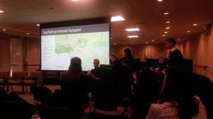
The event had three components aimed at engaging the audience of education professionals. CGA Director Tom Herman and CGA Geospatial Technology Coordinator Dr. Ming-Hsiang Tsou joined Dr. Hugh Howard (American River College) and a GIS Specialist for the Army Corps of Engineers on an expert panel. A highlight of the day was hearing from a group from the Math Science & Technology Magnet Academy at Roosevelt High School in Boyle Heights. The students attended with their outstanding English teacher, Alice Im, and presented their work examining relationships between school segregation and graduation rates and exploring environmental racism by comparing the health problems and government responses related to the Porter Ranch gas leak and the Exide Technologies toxic contamination case in Vernon. The CGA also hosted an informational table with our friends from The History Project at UC Davis to share GeoInquiries and how we are helping educators to engage their students in geographic inquiry using GIS.Continue reading CGA Supports GIS Day Event at CDE→
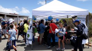
As a key sponsor of the Cabrillo Urban Island BioBlitz in San Diego, the CGA helped bring 250 High Tech High elementary school children to the park for a 24-hour BioBlitz on May 21st. This very successful event was organized in coordination with National Geographic, the National Parks Service and 119 other participating parks across the United States.
Kids had a wonderful time at the event. There were 68 exhibitors set up at the BioBlitz headquarters, offering an array of hands-on activities for kids. At the CGA exhibit, children had the opportunity to go on a BioBlitz scavenger hunt to help them with their map reading skills. Thanks to our SDSU Department of Geography cartographer, Harry Johnson, visitors were also able to examine an amazing air photograph and topographical map of Cabrillo National Park.
Participants in the Cabrillo BioBlitz collected an incredible array of species observations. In fact, over the park’s 166 acres, citizen scientists logged 1,551 observations of 405 different species. This placed the Cabrillo BioBlitz as #3 in the nation for iNaturalist BioBlitz observations!
On April 12th the CGA co-hosted a BioBlitz on the Sacramento Capitol grounds with 240 elementary school children from Bowling Green Elementary School. At this event, educators, naturalists, and students came together to learn about, and celebrate biodiversity in one of California’s most recognizable urban parks. The CGA collaborated with the Education and the Environment Initiative of CalRecyle to organize this hugely successful day. We all had a wonderful time, and students came to appreciate the importance of geographic, environmental, and outdoor education.
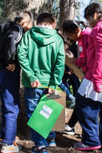
A BioBlitz is an intensive study of biodiversity carried out in a specific area over the course of a day. At our event, students from 3rd through 6th grade at Bowling Green Elementary observed and documented as many plants, birds, insects, mammals, fungi, and other organisms as possible. This gave them a great opportunity to become citizen scientists in their own backyard. They learned how scientists collect observational data, explored the diversity of life that exists even in an urban environment, and came to appreciate how humans influence biodiversity. Experienced naturalists were also on hand to help students identify local plants and animals. Additionally, the event hosted information booths on biodiversity, agriculture, recycling.
The Capitol Park BioBlitz is one of over 150 BioBlitz events being held around the country this year as part of a National Geographic Initiative marking the National Park Service Centennial. The California Geographic Alliance has joined with a wide range of partners in the California Outdoor Engagement Coalition to support over 25 BioBlitzes in California parks and schoolyards.
“Outdoor learning is an incredible opportunity available to any student,” said Tom Herman, Director of the California Geographic Alliance. “Geography education is about connecting students to the world and helping them understand their place in it, and engage in a meaningful way. Examining what is happening right outside your home or school is a great place to start, and biodiversity is an important issue.”
The media attended the event as well. Our Sacramento BioBlitz was featured on Sacramento’s Fox 40 news, as well as KCRA’s Channel 3. Watch our BioBlitz in action and watch CGA’s Director, Tom Herman, speak about the importance of geography education.
It is that time of year again! Hundreds of school level bees occurred throughout the state from November to January, with a winner being crowned at each school. Now the top 105 school winners have been selected by the National Geographic Society and invited to take their talents to Fresno to see if they can emerge on top of a very intense competition.
The competition will begin at 8 am on Friday, April 1 at the Satellite Student Union on the Fresno State campus. Once the preliminary rounds have been completed, the general public is welcome to come and watch the final and championship rounds, which will begin around 11 am.
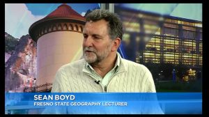
State Bee Coordinator Sean Boyd, of the Fresno State Geography Department, was recently interviewed on the Central Valley Today television news program, and you can view that segment here:
And a group of Mass Communication/Journalism students at Fresno State created a theatrical trailer for the Bee, which you can also view:
Good luck to all 105 competitors and congratulations to the thousands of students who participated in bees held at their school sites.
Join our BioBlitz partners at the King Gillette Ranch for this FREE workshop to investigate biodiversity in the Santa Monica Mountains and life’s enabling substance, water. By blending EEI and Project WET activities together the workshop will illustrate the three dimensional learning cycle that is integral to the Next Generation Science Standards. Educators get research-based planning tools that, when implemented with integrity, will bring immediate benefits to students. Ample time for collegial co-planning is built into the workshop as we explore biodiversity in the parks. This workshop is designed to support teachers planning to visit a National Park area with their class or participate in Bio-Blitzes in the park or at their own school sites – but all are invited to attend this training and get outside with us!
Resources for the teaching and learning of geography