We are happy to announce the availability of a completely updated and improved second edition of our popular student atlas of California!
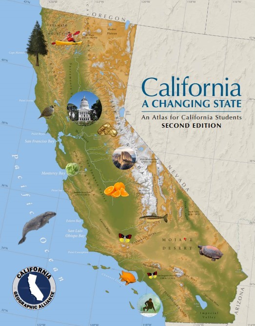
We are especially grateful to the National Geographic Society and the California Global Education Project for support of this update. Harry Johnson is responsible for the excellent cartography, and Sebastian Sindermann the page design and layout work.
California: A Changing State is a student atlas and standards-based teaching resource. While aligned with fourth grade standards, the atlas can be useful as a reference work for many other grade levels. In addition to the text included in the atlas itself, we have provided a map reading and interpretation guide and a set of seven thought-provoking geography inquiries. Students can use the atlas to respond to the inquiries, and then formulate and refine their own questions to continue their research.
Jump to the table of contents by clicking here.
Note that you can view the maps in your internet browser, but if you download the pdf files and open them in Adobe Acrobat Reader, you can turn on an overlay that will show the county names and boundaries on any individual map (more info on pdf layers here).
The atlas was originally created at Humboldt State University with support from the Richard and Rhoda Goldman Fund, S.D. Bechtel Junior Foundation – Stephen Bechtel Fund and the National Geographic Education Foundation.