Category Archives: Events

Cal State Fullerton Geography Department Welcomes AP Human Geography Students and Teachers

The CGA’s goal of creating a geographically competent workforce depends on increasing the quality of geography education in K-12 and making sure students see geography as a viable college major and career field.  Professor Zia Salim at CSU Fullerton is helping to build the bridge between high school and college-level geography.

Dr. Salim (far right of the photo) and the CSUF Geography Department hosted 100 students from La Habra High School on Dec. 4, 2015 as part of an outreach program to Advanced Placement Human Geography classes. The program included an exercise utilizing geographic information systems and presentations on a variety of geographic topics.  AP Human Geography is the fastest growing AP course nationwide, and we are excited to see high school students being exposed to what is happening at the university level so that they can give full consideration to geography as a field of study.

Creating links between geographers at the college and university level and geography and social studies teachers in their local area is one strategy that the CGA is looking to expand.  If you are a geographer that would like to connect with K-12 teachers and students, or a K-12 teacher looking to make a connection to a college or university in your area, please let us know!

Kimball Elementary in National City: Biodiversity Hotspot?

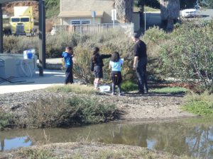
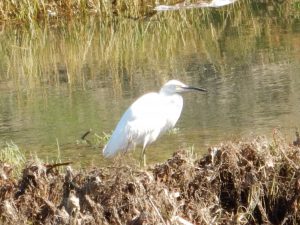
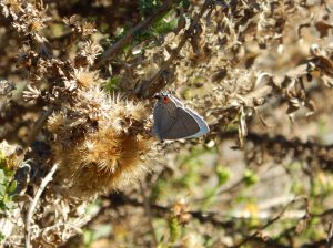
Under the direction of teacher Stephanie Buttell-Maxin, students in two 3rd grade Spanish immersion classes took to “the field” to study biodiversity firsthand as part of a schoolyard BioBlitz.   “The field,” in this case, is an area immediately adjacent to the school campus that includes a tidal creek.  While the area is far from pristine, it provides valuable habitat within an area that is heavily impacted by high density and industrial land uses.  Paradise Creek has provided a focal point for environmental education and community activism at Kimball, with students participating in water quality monitoring and site clean ups over the years.  BioBlitzing has also been a regular activity.

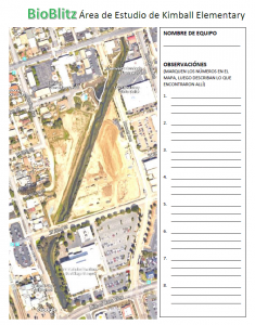
Kimball Study Area

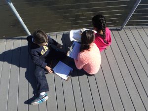
Before even starting the BioBlitz, Mrs. Maxin oriented the students in a thoughtful way by posing two compelling questions about biodiversity and plant and animal adaptations.  For the activity, we prepared materials to aide the students in making field observations.  Each was given a worksheet and a site map for taking notes, plus magnifiers and cameras that were shared among the students.  Mrs. Maxin keeps a wonderful collection of photos and plant samples so the students could use those as resources when trying to determine what they were observing.  Prior to heading out into the field, students were provided with some instruction on what naturalists do and coached in using all of their senses to examine the natural world closely. Each small group of 3-5 students was led by an adult, but students decided what to document and collected all of the data on their own.

OLYMPUS DIGITAL CAMERA

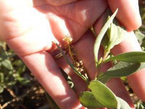
The students really enjoyed taking a closer look at a place they already knew well, and they were able to uncover new information.  They realized how many different kinds of plants occupied this small space, and they also experienced how challenging it can be to get a good photo of a moving target.  Their knowledge of the site also proved useful in guiding their investigations.  Students referred to their site maps and used map reading skills to mark the locations of their observations on that map.  While being naturalists, students also commented on how the trash left behind by people (and washed in by the tides) presented a challenge to the health of the plants and animals, and therefore to the well-being of the students themselves.  Civic involvement often means taking care of the place where you live, and they were motivated to make improvements to this place.

Kimball BB B 005

Kimball BB #2 026

Classroom activities reinforced the field activities.  Students reflected on their experiences in the field and responded to the questions about biodiversity and adaptations.  They made presentations about what they had learned.  A table top-sized reproduction of that site map was used in the classroom to transfer all of the observations onto a single map, reinforcing map reading skills and providing extra help for those students who struggled to relate the site map to the real space that they had just explored.  Finally, their best observations – those that included good photos and definitive locational information – were entered into iNaturalist, where a project had been set up specifically for the Kimball BioBlitz. With assistance from other users on iNaturalist, the group’s 28 observations yielded 17 confirmed species identifications within 24 hours of completing the project.  Another exciting development is that 13 of the observations have been certified as “Research Grade,” which means the students are contributing to scientific knowledge through “crowdsourcing” or “citizen science.”

Kimball BB D 009

Congratulations to Mrs. Maxin and the 3rd graders at Kimball Elementary for a job well done.  And thank you to the volunteers who helped make this a great experience for the students: Patricia Simpson, Christopher Maxin, Emanuel Delgado, and T Herman.


Building Leadership Skills with Geography and GIS Education: Notes from the SDSU Colloquium by Dr. Joseph Kerski

Written by CGA Geospatial Technology Coordinator Ming-Hsiang Tsou

What are the key skills required for a team leader? An effective leader needs to provide a 360 degree perspective and to have capabilities to solve problems by using multiple tools with limited resources. With hands-on skills and technological expertise, a team leader should be able to communicate with his/her team members effectively and to accomplish challenging tasks with collaboration from multiple people in different fields together. All these leadership skills and trainings are the key components in Geography and GIS education. As a teacher of Geography and GIS, I would like to ask every Geography teacher and GIS educator to re-think the goals of Geography and GIS education. To equip students with leadership skills and deep-thinking capability, we should transform Geography education toward the development of team leadership for our community.

Understanding local to global challenges, learning geospatial technology and tools, using geo-enabled devices effectively (such as smart phones and navigation systems) are exemplars of important geography education content that can build the fundamental skills of team leadership for students. These examples were highlighted by Dr. Joseph Kerski during his colloquium speech on September 12th, 2014 at San Diego State University.

In our GIS education community, Dr. Joseph Kerski is a perfect example of a true team leader who is also an outstanding geographer. With a full house at SDSU’s Colloquium on Friday afternoon, Dr. Kerski delivered an insightful and inspiring presentation focused on learning geospatial tools and thinking critically and spatially about our world.
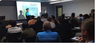
Kerski_at_SDSU

It is a great honor for California Geography Alliance and the Department of Geography to host Dr. Joseph Kerski’s colloquium. Dr. Kerski received his Ph.D. from the University of Colorado in 2000. He is the Geographer and Education Manager at ESRI and an adjunct Professor at University of Denver. With an impressive publication record (five books and over 40 journal articles, papers, and book chapters), Dr. Kerski is probably the most well-known GIS education “guru” in the world.

To demonstrate the definition of “guru”, I would like to share the SDSU story map made by Dr. Kerski when he just arrived to SDSU in the morning before his talk (Figure 1). Here is the actual link: http://www.arcgis.com/apps/MapTour/?appid=61035b310fcd425dbf9d722da62c80de. He created this wonderful Story Map by using his mobile phone only and revealed these beautiful scenes around the campus visually and spatially. Very cool and effective!
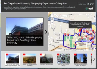
Kerski_SDSU_StoryMap

Joseph is my life-long friend (over 18 years) and one of the most admirable scholars in the GIS community. He and I spent 4 years together in the University of Colorado at Boulder during our Ph.D. programs.

In order to share his great presentation to the members of California Geography Alliance, we have posted a few sections of his colloquium videos in our YouTube Channel. You can access them from here: http://calgeography.sdsu.edu/featured-talks/.

Let’s train our next generation of geographers to become the team leaders in the 21st Century!

Ming from San Diego
mtsou@mail.sdsu.edu

Why We Need Geography Education

Good news: This week is Geography Awareness Week! Why do we need Geography Awareness Week? Because in order to become well-informed global citizens, American students need geography education. As the world becomes more interconnected through globalization, geography education can help us make sense of rapid global change. This is essential, particularly in light of political and military interventions abroad. For instance, when Russia moved into the Crimea in March 2014, a survey revealed that only 1 out of 6 Americans could locate Ukraine on a map. The further Americans believed Ukraine was from its actual location, the more they supported US military intervention (Washington Post, 2014). This is a problem.

Geography as a discipline has changed substantially over the last several decades. We do a lot more than maps! In our department at San Diego State University, our research spans the social and physical sciences. We study everything from vegetation, climate, hydrology, and soils to urbanization, migration, sustainability, and globalization. Many also specialize in Geographic Information Science (GIS) to develop applied solutions for real world problems.

For this year’s Geography Awareness Week, the theme is ‘The Future of Food’. By exploring the geographies of food, we gain a better sense of how the food we eat is part of a global commodity chain linking people, places and environments around the world.

The California Geographic Alliance, along with National Geographic, invite students, teachers, and community members to participate in GeoWeek 2014. GeoWeek is an opportunity to learn more about geography, while drawing attention to the need for policies to improve American students’ access to geography education. Get started by going to GeographyAwarenessWeek.org, where you can discover ways to participate in GeoWeek and find ideas and free resources to organize your own GeoWeek celebration.

Celebrate GeoWeek and spread the word about the importance of geography education!