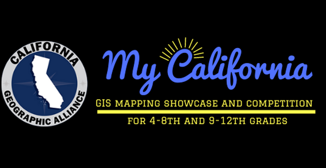
Explore Data About Your Place in the World Using Geography and GIS

Get to know your community better. Studying the people and the environment in the place where you live has numerous benefits.

  • A local scale inquiry builds on experience and insights that you are already accumulating through your everyday lived experiences.
  • You can take advantage of opportunities for experiential learning and develop your skills through direct observation and interaction.
  • You can connect learning to civic action and find ways to contribute to your community based on what you are learning.

These are two tools designed to help you access, collect, and learn from information about your local area. These can help you better understand the place where you live and study. They can also help you find ways to connect with and contribute to your community.

  • Community Environmental Justice Screening Tool (PDF)
  • 2020 US Census Community Demographic Data Collection Sheets (PDF)

My California GIS Mapping Showcase and Competition – 2023 Winners

The California Geographic Alliance is proud to announce the winners of the 7th Annual My California GIS Mapping Showcase and Competition.

This exciting statewide opportunity encourages middle (4th-8th grade) and high school (9th-12th grade) students to harness the power of Geographic Information Systems (GIS) and connect with their state by producing a StoryMap. The state competition is part of a national competition sponsored by Esri, creators of ArcGIS Online software and educational resources that are freely available to K-12 schools. $100 in prize money is allocated to the student author(s) of up to five award-winning projects in each division. The first place project in each division also advances to the national competition.

Continue reading My California GIS Mapping Showcase and Competition – 2023 Winners

Environmental Justice for California Communities: An Interdisciplinary Workshop Series for Secondary Teachers

This is an exciting Professional Learning program presented by the California Environmental Literacy Initiative, several California Subject Matter Projects, and the California Geographic Alliance. We are excited to support a cohort of teachers to become leaders in using an exciting new resource for place-based environmental learning and action.

In the 3-part series, teachers will get experience with classroom-ready resources and will learn how they and their students can use geospatial tools to develop their own inquiries. The CHELA (California’s Hub for Environmental Learning and Action) website helps educators, students, and collaborators:

  • use powerful GIS mapping tools to access current data and visualize, understand, and analyze important issues in a way that centers their own communities and concerns, wherever in the state they may live;
  • follow their interests and hone their own questions across a broad range of topics related to the environment, sustainability, and environmental justice; and
  • share their stories of environmental learning, action, and advocacy.

Continue reading Environmental Justice for California Communities: An Interdisciplinary Workshop Series for Secondary Teachers

Celebrate California Biodiversity Day by Documenting Biodiversity in Your Spaces, Sept. 4-12

To recognize California Biodiversity Day , the California Geographic Alliance is organizing students across the state to become Biodiversity Explorers and Mappers. In the interest of developing environmental literacy and stewardship in all young people, this will be an opportunity for close observation and appreciation of the amazing diversity of organisms present in our state, which is a global biodiversity hotspot.

Continue reading Celebrate California Biodiversity Day by Documenting Biodiversity in Your Spaces, Sept. 4-12

Announcing the Winners of the 2021 Student GIS Mapping Competition

Image including CGA logo and title of contest: "My California GIS Mapping SHowcase and Competition for 4th-12th grades"On May 12, the California Geographic Alliance announced the winners of the 5th Annual My California GIS Mapping Showcase and Competition. This exciting statewide opportunity encourages middle (4th-8th grade) and high school (9th-12th grade) students to harness the power of Geographic Information Systems (GIS) and get connected with their state by producing a StoryMap that focuses on stories, issues, or ideas that are important to them. The state competition is part of a national competition sponsored by Esri, creators of industry-leading ArcGIS Online software that is freely available to K-12 schools. $1,000 in prize money will be distributed to the students producing the top five projects in each division. The first place project in each division will also be advanced to the national competition.

The My California contest is coordinated by Dr. Waverly Ray, Associate Professor of Geography at San Diego Mesa College. A panel of academic and industry experts, all of whom serve as volunteers, serve as competition judges. Dr. Ming-Hsiang Tsou, Professor of Geography at San Diego State University, has served as head judge for the competition since its inception. The CGA is grateful for this support!

The CGA also sincerely thanks all of the superhero educators across the state who, despite all the challenges of this year, gave their students the great experience of using GIS to create their own maps and projects. Teachers are the best, and we appreciate your help in bringing the power of geographic thinking and geospatial technologies to your students.

And now the real stars of the show… Continue reading Announcing the Winners of the 2021 Student GIS Mapping Competition

SDSU Geography Class Examines Impact of COVID-19 on Campus Community

Students in San Diego State University’s Geography Department‘s course on Qualitative Methods in Geography (taught by Dr. Kate Swanson) worked together to produce this excellent StoryMap that examines the impact of COVID-19 on the SDSU community.

This is information and perspective that you won’t get anywhere else, and geography helps pull it all together. Congrats to Dr. Swanson and the whole team!

From Dr. Swanson: “Overall, our findings pull from 458 student surveys, 131 faculty surveys, as well as 24 interviews with students and faculty. The StoryMap integrates graphics, recordings, maps, office space photos, and compelling first-hand testimony to uncover how students and faculty are coping. Key sections include: student financial report; housing, food security and education impacts; impacts of online learning on student well-being; and impacts of online learning on faculty well-being. We conclude with a series of recommendations. I’ve attached a few figures to highlight some of our findings.

Please share widely! My students are really excited to share their impressive work. We hope that these findings help uncover further ways to support students and faculty during these difficult times.

A special shout-out to Ana-Felix Ibarra who put the StoryMap together! It’s beautiful!

This image shows the professor and students in the Qualitative Methods in Geography course at SDSU while engaged in a Zoom call.

Geography Awareness Week Daily Webinars

During this year’s Geography Awareness Week, the CGA hosted daily live webinars (Mon-Fri, Nov. 16-20) to connect educators and students with the discipline in a variety of different contexts and demonstrate how geographic perspectives can deepen our understanding of the world we live in and contribute to more sustainable and equitable communities and a better global future. Special thanks to Candice Mays of Mapping Black California/Black Voice News; Nicole Goggin of Global Nomads Group; the California EcoBlitz team of Dr. Anna Antoniou, Jessica Lura, and Kimi Waite; and amazing geography graduate students from SDSU – Jasmine Arpagian, Corrie Monteverde, Sam Orndorff, Thomas Smith, and Krista West.

Webinar recordings:  MondayTuesdayWednesdayThursdayFriday

Image lists daily topics for webinars to be held Nov. 16-20, 2020.

Student Atlas of California Completely Updated and Available Now Online

We are happy to announce the availability of a completely updated and improved second edition of our popular student atlas of California!

Image shows front cover of student atlas titled California: A Changing State, second edition. Cover shows map of California with icons representing recognizable features of the state.

Continue reading Student Atlas of California Completely Updated and Available Now Online