Category Archives: Uncategorized

BREAKING NEWS – Winners of My California GIS Mapping Competition

The CGA’s first ever statewide GIS mapping competition for 4th through 12th grade students has concluded.  5 students projects have been selected as state finalists in each of two divisions.  The authors of each project will be awarded a prize of $100, and the projects will be advanced to the national competition.  5 other projects have been selected for Honorable Mention.

The CGA wants to thank:

  • the NorCal Chapter of URISA and the California Geographic Information Association for their generous support of this competition;
  • the 29 schools that registered for the competition, including all the teachers and students who invested their time in creating projects about their state;
  • all of the judges who lent their time and expertise to scoring the entries and selecting the very best;
  • and Dr. Waverly Ray who took the lead in coordinating the competition and brought enthusiasm and skill to the task!

Without further ado, we present the winners. Continue reading BREAKING NEWS – Winners of My California GIS Mapping Competition

Meet the Judges for the My California GIS Mapping Exhibition and Competition

Janet Brewster

GIS Specialist, California Department of Fish and Wildlife

  • My career has spanned multiple disciplines, and GIS has moved right along with me. From environmental planning to facilities to land and wildlife conservation, I have been able to use GIS to conduct analyses, create and manage data, and make connections that weren’t otherwise possible. But perhaps best of all, I can share all of this information on a map, rather than in a dry list of names and numbers. Who doesn’t love a good map?!

Continue reading Meet the Judges for the My California GIS Mapping Exhibition and Competition

Get Your Students Involved in the My California GIS Mapping Exhibition and Competition!

UPDATE:

With registration for the competition now closed, the CGA is happy to report that 29 schools have registered for the competition.  That could mean as many as 145 student entries in the state final!

An illustrious panel of eleven judges has stepped forward to evaluate and rank the student entries, so we are all set for an exciting competition.  Thank you to all of our volunteer judges!

Click here to see a map of schools registered for the competition.

_______________________________________________________________________

The California Geographic Alliance is hosting an exciting statewide mapping showcase and competition that encourages middle (4th-8th grade) and high school (9th-12th grade) students to harness the power of Geographic Information Systems and get connected with their state by producing an online map that focuses on stories, issues, or ideas that are important to them.

Registrations due March 15, 2017!

Go to the contest page for full details.

Thanks to the Northern California URISA Chapter and the California Geographic Information Association for their generous support of this effort!

Meet the competition judges

Amazing lineup of geography sessions and workshops planned for CCSS conference in Sacramento

Planning on attending the California Council for the Social Studies Conference in Sacramento, March 3-5?

The CGA is proud to be a Silver Sponsor of the conference, and we are even more excited to be sponsoring an amazing array of sessions and workshops. Come visit the booth in the exhibit hall to learn about the latest resources and see some incredible maps, and please check out these great sessions.

FRIDAY Continue reading Amazing lineup of geography sessions and workshops planned for CCSS conference in Sacramento

California Giant Traveling Map Available for 2017!

The Network of Alliances for Geographic Education has an exciting new national initiative for 2017: the State Giant Traveling Map Program.  At least two giant maps of California (17 x 21 feet, so not as large as the giant continent maps) will be circulating the state beginning in January.  The maps are specifically designed for use by 3rd and 4th grade students, and they come with lesson plans designed by National Geographic and tied to standards for those grades.

Continue reading California Giant Traveling Map Available for 2017!

GEEO Helps Educators Make International Travel Part of Professional Development!

At the CGA, we see geographic knowledge and skills and global citizenship as intertwined and mutually supportive. Therefore, we encourage educators to use travel as part of an individualized professional development strategy. We are happy to share the following information from GEEO, a unique non-profit organization designed to serve educators and offering a fabulous range of travel experiences at reasonable cost.

balkansdrbuvnik_kyle_taylor-_kyle_taylor_dream_it-_do_it_banner_with_credit

Continue reading GEEO Helps Educators Make International Travel Part of Professional Development!

Support the AAG’s Proposal for a New Advanced Placement course in Geographic Information Science & Technology

CGA members who are US high school teachers, here is a chance to help connect high school educational programs to real-world work skills and career opportunities in a new way…

Support the AAG’s Proposal for a New Advanced Placement course in Geographic Information Science & Technology

Continue reading Support the AAG’s Proposal for a New Advanced Placement course in Geographic Information Science & Technology

California State Geographic Bee to be Held Friday April 1 at Fresno State University

It is that time of year again!  Hundreds of school level bees occurred throughout the state from November to January, with a winner being crowned at each school.  Now the top 105 school winners have been selected by the National Geographic Society and invited to take their talents to Fresno to see if they can emerge on top of a very intense competition.

The competition will begin at 8 am on Friday, April 1 at the Satellite Student Union on the Fresno State campus.  Once the preliminary rounds have been completed, the general public is welcome to come and watch the final and championship rounds, which will begin around 11 am.

State Bee Coordinator Sean Boyd, of the Fresno State Geography Department, was recently interviewed on the Central Valley Today television news program, and you can view that segment here:

Sean Boyd from CVT 2016

And a group of Mass Communication/Journalism students at Fresno State created a theatrical trailer for the Bee, which you can also view:

GeoBee Trailer

Good luck to all 105 competitors and congratulations to the thousands of students who participated in bees held at their school sites.

Bringing Insights of Geographic Research to Geography Education Practice

Greetings from the Alliance Network Annual Meeting at National Geographic Society headquarters in Washington, DC.  We are hearing about changes in the way in which the Alliance network is organized and supported, and in the coming months there will be news to share about new initiatives and new activities, and we think there will be some things you can get excited about and use to get students engaged in learning.  More on that to come, but for now we want to share something that is a little bit outside the box of our usual Alliance work, but still very related.

Many of you may not know that the CGA team at San Diego State – in particular Stuart Aitken, Thomas Herman, and Kate Swanson – are also involved in conducting geographic research on the geographies of children, youth, and families.  The concept of “geographies of children and youth” may be new to you, but because most of you work with children and youth on a daily basis, you will find it a familiar topic.  It is an interdisciplinary field including education, environmental design, and sociology researchers who share an interest in places and spatial relationships.  They examine the ways in which adults make space for children, youth, and families (playgrounds and suburban neighborhood design are simple examples). They are also interested in ways in which children and youth interact with and modify their environments (think about the old Family Circle cartoon that shows how the child who says she came straight home from school actually took a circuitous route throughout the entire neighborhood or the way kids tend to gravitate to forts and treehouses away from adults’ spaces).  This field has grown significantly over the past 20 years, as is reflected in academic journals and in the number of disciplines who are using geographic thinking to examine the lives and well-being of children, youth and families.

In January, we hosted the 4th International Conference on the Geographies of Children, Youth, and Families in San Diego.  Over 160 researchers from 32 countries attended the conference, and they presented a wide range of ideas and evidence about what is happening in the lives of children and young people.  If you are interested in learning more about the conference, you can check out the conference web site at: http://icgcsandiego.wix.com/ypbw or the ISYS Center web site at http://geography.sdsu.edu/Research/Projects/ISYS/.

One big takeaway message for us as Alliance leaders and for all geography educators is this:  Valuing the perspectives, concerns, experiences and voices of youth with regard to issues such as life in their community, what it means to be a Californian or an American, and how do we conserve our global environment will create incredible motivation for students to accumulate geographic knowledge and activate geographic thinking.  You already know that, probably, but it is helpful to have an occasional reminder and some encouragement.  We have lots of things to teach, some grounded in standards and some grounded in personal values, but we would encourage you to make sure that on a regular basis you are giving students an opportunity to exercise their voices, analyze their environments from their own perspectives and the perspectives of others, and express their ideas for a brighter future.

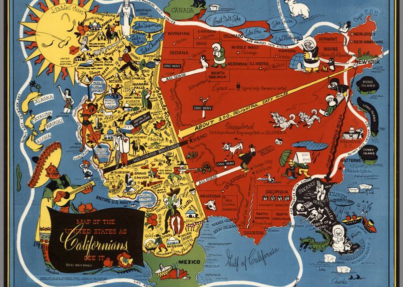
An example of this came from a plenary speaker at the conference.  Professor Katharyne Mitchell from the University of Washington gave a talk entitled “Counter-mapping with Children.” She taught students about the fact that maps reflect one view on a place, and that they reflect power relations and, often, official designations.  They leave out some features and labels to make room for others that the mapmaker thinks are important to show on the map.  Maps can therefore exclude the perspectives of minority groups or of people who do not possess official power and status (i.e., children).  Dr. Mitchell then worked with the children to examine the perspectives of specific groups in the Seattle area where she works.  The students focused on the perspectives of women, Asian-Americans, and African Americans and produced alternative maps for the city that elevated those perspectives.  The activity built social and historic knowledge of the students while also engendering empathy and, wait for it…..geographic knowledge, skills, and ways of thinking!  Sounds great, right?  Only a shame she is not in California.  However, immediately after the talk we had a chance to learn that Dr. Nancy Erbstein at the University of California-Davis is doing very similar work in California.  A new collaboration is hopefully emerging from that conversation so we can share Dr. Erbstein’s work (and methods) with all of you.  But you don’t need to wait.  Have your students map their community.  Have them look at maps of their home area and talk about what is shown on the map.  Have them talk to others in the community about the places that are significant to them and check to see if they are shown on the maps you can access.  Have them produce alternative maps that do reflect these features.  It will be fun and relevant and it will build geographic knowledge and skills.  It will hopefully also tap into their natural curiosity and lead to lifelong learning.

Learning by doing: GIS, GPS and building a scavenger hunt (a model activity for after school)

Article by Kitty Currier, graduate student at UC-Santa Barbara [currier (at) geog.ucsb.edu]

(Editor’s note: The CGA thanks Ms. Currier for providing this excellent article and making the related resources available to our members. We welcome submissions from any CGA member or geography educator who would like to share a lesson plan or learning activity.)

Leather craft, archery, and sheep showmanship were activities I pursued as a youth member of the All-American 4-H Club of Fort Collins, Colorado. Rooted in an agrarian past, the youth development organization 4-H has since expanded its focus to include the STEM disciplines—science, technology, engineering, and math—in its mission to foster leadership, citizenship and life skills in children. “Maps and Apps” was the national 4-H science theme of 2013, recognizing that geospatial technology and reasoning skills are essential to many of today’s careers and approaches to solving problems.

To align with the “Maps and Apps” theme, members of UC Santa Barbara Geography’s Outreach Committee and the Center for Spatial Studies developed and delivered the workshop Building a UCSB Scavenger Hunt. Following the 4-H “learn by doing” approach, the workshop was designed to teach participants how to read and navigate with a map, use a GPS receiver to collect geospatial data, and visualize their data using Google Earth. Approximately thirteen 4-H members ages 9–16 participated in the workshop, which was held on three consecutive Saturdays on the UCSB campus.

Each day had a different focus, beginning with basic map reading and culminating in the final project—a scavenger hunt, designed and created by the participants, themselves. On Day 1, participants followed self-guided tours adapted from UCSB’s Interactive Campus Map (http://map.geog.ucsb.edu/). Day 2 was devoted to data collection, where participants selected and navigated to different locations on campus; recorded their latitude–longitude coordinates using a GPS receiver; devised trivia questions; and shot descriptive photographs. Participants synthesized their data on Day 3, when they were tasked to design their own scavenger hunt in pairs. Each pair developed their own design that included a map created in Google Earth, trivia questions, and photos, all assembled on two letter-sized pages.

Post-workshop feedback from the participants was positive. The highlight of each day was the activity session (i.e., map navigation, collecting data, and producing paper scavenger hunts), but from a teacher’s perspective, the discussion, presentations and individual writing time helped participants realize that they were learning skills in addition to having fun. An important component of the workshop was the paper scavenger hunt that each participant brought home on Day 3, which they could share with their families and friends as a product of their own making.

One challenge that we anticipated was the range in age (9–16) of the participants. We designed the workshop to require no prior knowledge of the material, but inevitably participants arrived with different levels of competence. The age range turned out not to be a problem, however. As members of the same 4-H club, the participants all knew each other, and the older participants were used to mentoring the younger ones. If this workshop were to be delivered to a group of participants who were not as comfortable working together, however, such a difference in ages might pose a greater challenge.

Following are guidelines, templates, and our “lessons learned” for anyone wishing to adapt and offer a similar activity. More complete information about each day’s activities, along with a comprehensive materials list, can be found in the included example files, noted in red.

Schedule, Locations & Example Files
Day 1: Introduction to Map Reading (lecture classroom & outside)
Day 1_outline
Day 1_UCSB campus map
Day 1_UCSB walking tour example
Day 2: Field Data Collection (lecture classroom, outside, & computer lab)
Day 2_outline
Day 2_gps
Day 2_photos
Day 2_questions
Day 3: Mapping with Google Earth & Creating a Scavenger Hunt (computer lab)
Day 3_outline
Day 3_google earth exploration
Day 3_plain UCSB basemap example
Day 3_scavenger hunt template

Personnel & Structure
Four graduate students developed and led the workshop, which was attended by 6–13 participants each day. On days 1 and 2 an additional one or two adults assisted with the outside activity. Each day was allotted three hours and consisted of (a) an introduction to the day’s topic, given by the leaders; (b) a hands-on activity, where the participants practiced a skill; and (c) reflection and writing about the day’s activities. The structure was partly dictated by the 4-H program’s emphasis on presentation and record-keeping skills.

Budget
Our total budget was approximately $150, the majority of which was used to purchase four secondhand digital cameras and storage media. We borrowed GPS receivers for the activity at no cost from the Department of Geography.

Lessons learned
> Use existing campus maps & tours as resources when possible (e.g., for Day 1 map-reading activity).
> Be ready with an activity for the start of each day to occupy participants who come early; inevitably, some participants will arrive late.
> Have on hand participants’ parent/guardian contact information and relevant medical history/needs.
> Be prepared for fluctuation in attendance, and ensure that your plan is flexible enough to accommodate participants who miss a day.

Group photo of 4-H members on UCSB campus
Figure 1. Day 1, ready to go! (Photo credit: Erin Wetherley)

Marcela teaches some map basics
Figure 2. Marcela teaches some map basics. (Photo credit: Erin Wetherley)

Participants study their GPS receivers
Figure 3. Participants study their GPS receivers. (Photo credit: Kitty Currier)

Participants explore Google Earth
Figure 4. Participants explore Google Earth. (Photo credit: Haiyun Ye)

Kitty, Susan, and participants inspect the final scavenger hunts
Figure 5. Kitty, Susan, and participants inspect the final scavenger hunts. (Photo credit: Haiyun Ye)

Three distinct approaches to scavenger hunt design
Figure 6. Three distinct approaches to scavenger hunt design.